


-
Precision Mapping
Inhabitect provides precise topographic data and high-resolution photos for insightful site analysis and decision-making. Our centimeter-accurate maps are affordable solutions, guiding choices on home placement, shoreline access, or native landscapes.
-
Technological Innovations
Inhabitect advances construction technology with tools like drones and GIS mapping. We ensure accuracy and creativity in project documents, using drones for everything from surveys to construction documentation, setting us apart as a design and build company committed to innovation.
-
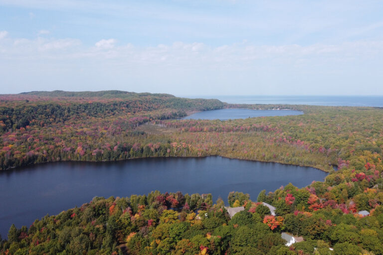
Environmental Monitoring
Inhabitect, as an ecologically driven company, uses aerial imagery to monitor ecosystems, wildlife habitats, floodplains, and more. Our bird’s-eye view enables informed decisions, supporting biodiversity through the responsible use of tools and data.
-
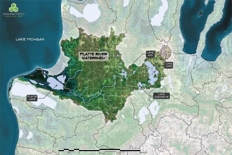
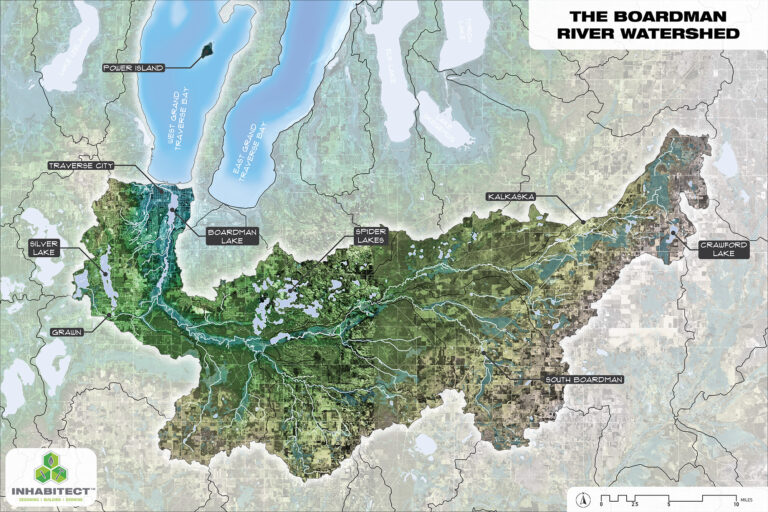
Resource Management
Inhabitect uses drone surveys for essential information on natural resources, watersheds, farms, orchards, and parklands. This informs responsible and sustainable management, providing a comprehensive perspective for preserving or enhancing your site.
-
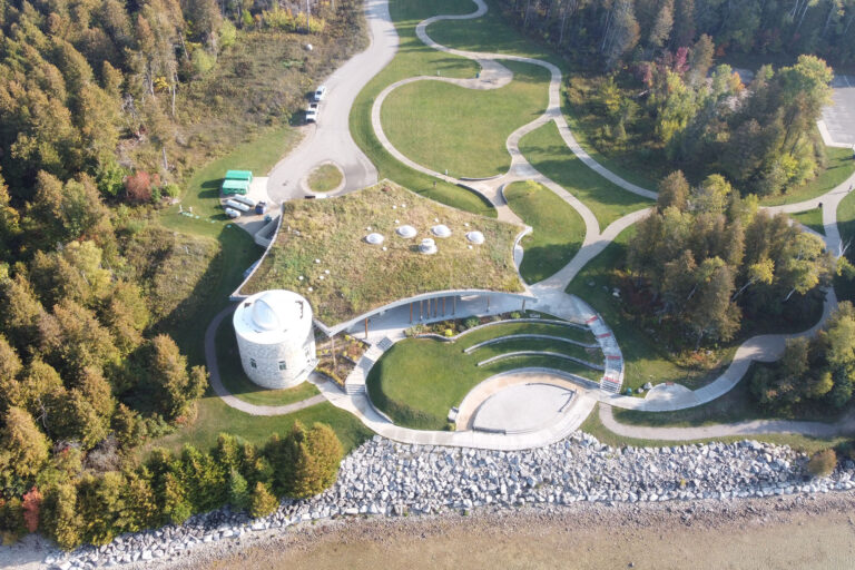
Advanced Urban Planning
Aerial surveys of urban sites, cityscapes, or corporate campuses are pivotal for Inhabitect's urban planning. Identifying development opportunities, evaluating infrastructure demands, and optimizing layouts for sustainability are achieved by importing these maps into our GIS system, enhancing our Green Stormwater Infrastructure planning in complex scenarios.
-
Optimized Infrastructure Planning
Inhabitect employs accurate surveys to strategically place both traditional and green stormwater infrastructure elements. The resulting data and maps aid in precise placement decisions for driveways, roads, homes, and larger-scale elements like public transportation routes or developments.
-
Efficient Resource Allocation
The synergy of drone surveys and GIS equips Inhabitect with data-driven design solutions for your project. This comprehensive information enables us to allocate resources, manage budgets, and enhance project efficiencies. As both an ecological design company and contractors, we leverage this data to align designs with your budget and ecological goals.
-
Precision Mapping
Inhabitect's advanced drone and GIS mapping system ensures precision down to the centimeter. This high level of accuracy safeguards your investment in site design and planning, avoiding overlooked details that can lead to costly mistakes. Our goal is to enhance efficiency and prevent such oversights in the design process.
-
Informed Decision Making
Inhabitect's thorough data collection and mapping enable us to make informed decisions throughout your project's planning phase. This approach ensures that every decision is backed by comprehensive and accurate information, enhancing the overall success of your project.